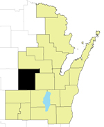
Waupaca County
Waupaca County, created in 1851 from Brown and Winnebago Counties, is named for the Menominee word "wau-pa-ka-ho-nak," which means "white sand bottom" or "brave young hero." Located in central Wisconsin, the county seat is Waupaca.
Website: https://www.waupacacounty-wi.gov/
Regional Planning Commission: East Central
Land Area: 751 square miles
Coordinated Public/Human Service Transportation Planning
Transportation coordination involves human service agencies,
transportation providers, consumer groups, and public officials
working together to develop and improve services for individuals
unable to provide their own transportation. Many of those served are
not able to provide their own transportation as a result of
disability, age or income. Transportation coordination provides more
rides to more consumers through cooperation, communication and
sharing resources, ensuring that transportation resources funded by
local, state and federal programs are well-managed.
Source:
https://wisconsindot.gov/Pages/doing-bus/local-gov/astnce-pgms/transit/compliance/coord.aspx
Current Plan: 2024 Waupaca County Specialized Transportation Coordinated Plan
